
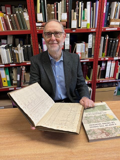
A map of Frome Selwood Parish and an associated survey book from 1813 have been reunited at Frome Museum after 60 years.
The hand-drawn map, commissioned by St John’s Church in 1813 as a copy of the Longleat version, measures 11 x 8 feet and cost £150 at the time (around £9,000 today). The commission included a manuscript survey book detailing over 3,000 plots, with their owners and occupiers recorded in 1814.
In 1965 the map was donated by the church to the Frome Society and later transferred to the newly established Frome Museum. The survey book, however, remained in St John’s archive until last year, when it was also donated to the museum.
Michael Maggs, chairman of Frome Museum, said, “The Parish invested in the map and the survey together as a complete record of land ownership, which would have been important in establishing tithes and church rates. The fact that both survive intact is amazing.”
The map has been held at Somerset Heritage Centre since the 1980s, and the survey book will now join it. Visitors do not need to travel to Taunton to see them: a full-scale facsimile of the map, along with a complete transcript of the survey book, has been published by Frome Society in atlas form and is available for £30 from Frome Museum and local bookshops.
Pictured: Michael Maggs with the original manuscript and the Cruse Atlas


, Jenny Mitchell, Nicholas Shakespeare, Andrew Miller, Lily and Harriet, Claire Fuller")
